The Ferraris map, produced under the direction of Count Joseph-Jean François de Ferraris in 1777, depicts the landscape of the Austrian Netherlands and the Prince-Bishopric of Liège. It is the very first large-scale map of what largely corresponds to present-day Belgium. Never before had a Western European country been mapped with such detail and precision.
Historical context
In the second half of the 18th century (until 1794), the Southern Netherlands were part of the Habsburg Austrian Empire. Count Joseph-Jean François de Ferraris (Lunéville 1726 – Vienna 1814), originally from Lorraine, had close ties with the Austrian court. During the Seven Years’ War (1756–1763), he met his future patron, Prince Charles of Lorraine (1712–1780), then Governor of the Southern Netherlands.
In 1767, Ferraris became Director-General of Artillery in the provinces and head of the École des mathématiques in Mechelen. In this capacity, and at the request of Charles of Lorraine, he was responsible in the late 1760s for surveying the Sonian Forest and its surroundings, as well as the royal estate of Mariemont.
Ferraris’ Proposal
In 1769, Ferraris proposed to Charles of Lorraine the idea of surveying a map of the entire Austrian Netherlands. With this large-scale map, he aimed to accurately represent the position of cities, towns and hamlets, as well as large and small castles, streets, squares and gardens.
Ferraris planned two maps: A first, detailed and hand-drawn map at a scale of 1:11,520, intended exclusively for the cabinet, ministers and generals. This was called the Carte de Cabinet or Cabinet Map. A second, less detailed map at a scale of 1:86,400, intended for the general public, known as the Carte marchande or Carte chorographique.
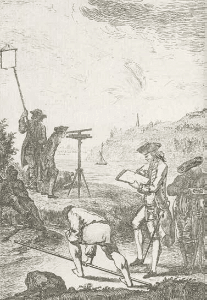
On 11 August 1770, thanks to the support of Charles of Lorraine, the project was approved by Empress Maria Theresa. The surveys began shortly after imperial approval, using a plane table (planchette), a drawing board mounted on a tripod equipped with a level, compass and alidade.
Dupain de Montesson, L’art de lever les plans […], Paris, Ch. Ant. Jombert, 1775, title plate (KBR, Maps and Plans, iv 15 123 a)
The Cabinet Map
Three copies of the Cabinet Map were produced: one for the Emperor, one for the Court Chancellery in Vienna, and one for Charles of Lorraine.
The copy intended for Charles of Lorraine is now held in our collections. It was transferred to Vienna after Austria’s defeat by France and was only returned to Belgium in 1922 as part of post-war peace negotiations, thanks to the efforts of Albert Tiberghien, librarian at the Royal Library of Belgium and curator of the map collection.
In the upper left corner of each sheet appears the coat of arms of Charles of Lorraine, preceded by a capital letter and followed by the sheet number. The margins of each map sheet indicate the four cardinal directions, and the scale is shown at the bottom.
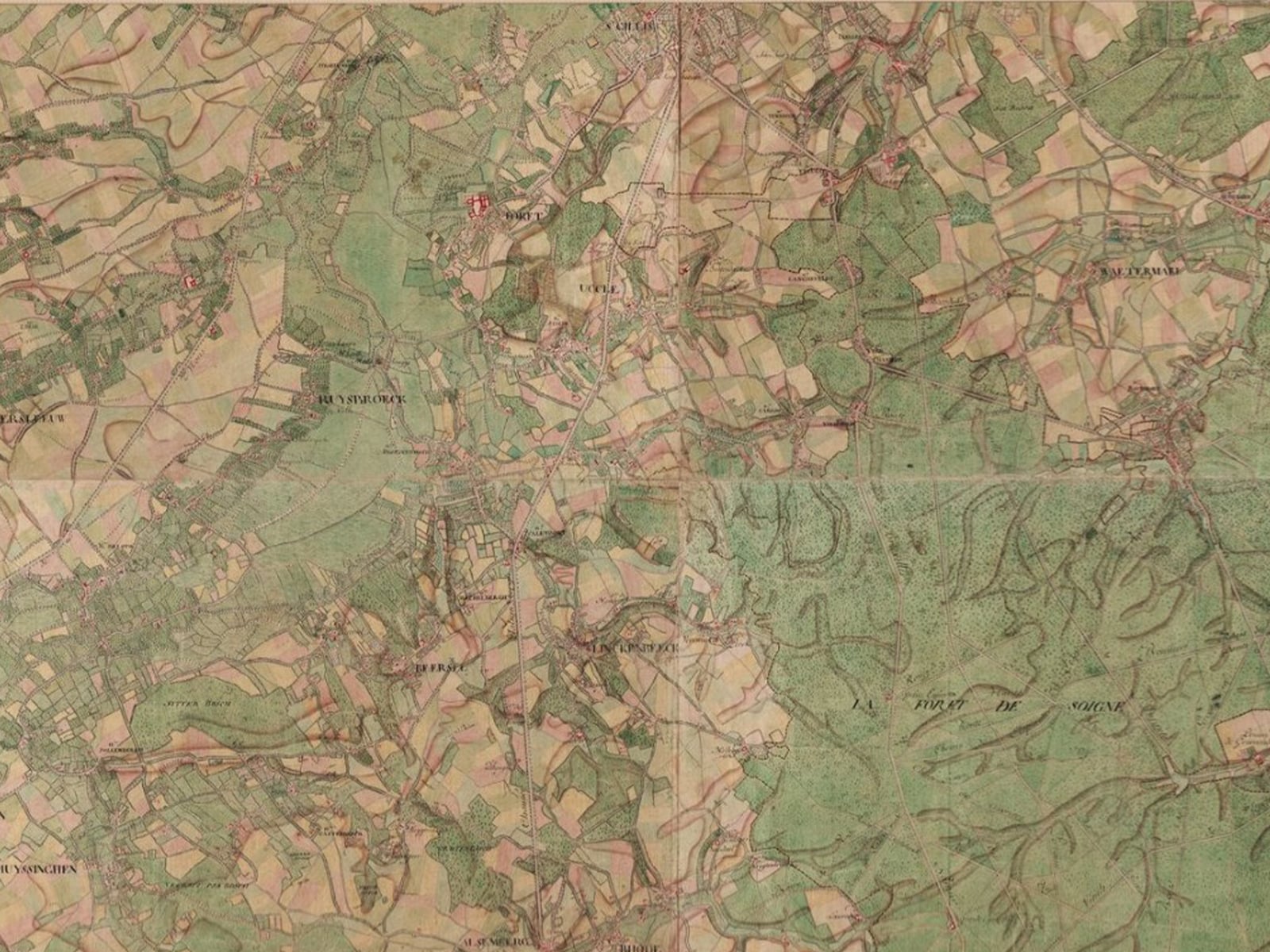
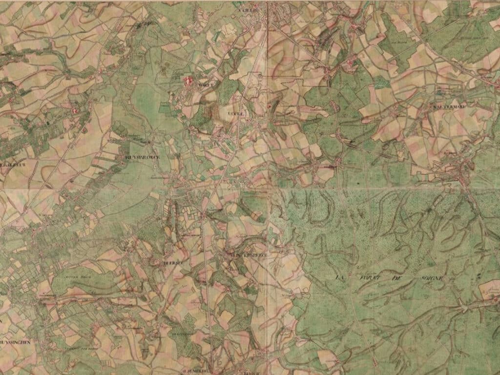
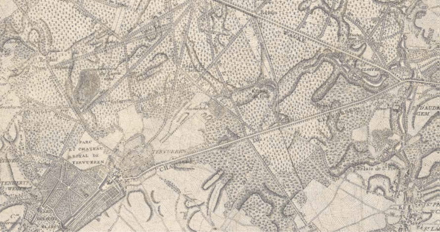
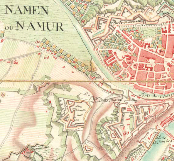
Detail of the Cabinet Map, sheet 116
The Historical Value of the Ferraris Map
First and foremost, the Cabinet Map is the very first large-scale map of present-day Belgium. It also contains a wealth of historically valuable information. For example, it documents the administrative and judicial situation of the Austrian Netherlands and the Prince-Bishoprics of Liège and Stavelot at the end of the Ancien Régime, before the major reforms imposed by the French Republic.
The map also provides insight into religious practices during the Ancien Régime. Parish churches where mass was celebrated are marked with a black cross and a number. The same number, in smaller form, appears next to the houses belonging to the same parish.
Finally, and not least, the map is an important source for the study of Belgian toponymy, with nearly 10,000 hamlets and farmsteads, more than 600 street names, and over 2,700 waterways indicated.
The Ferraris Map Online
The Maps and Plans Department, together with the National Geographic Institute (NGI), has also created a digitised version of the Ferraris map. This was based on the digital map of Belgium published by the NGI in 2006. The handwritten maps were digitised using a large-format scanner.
A New Edition of the Great Atlas by Ferraris
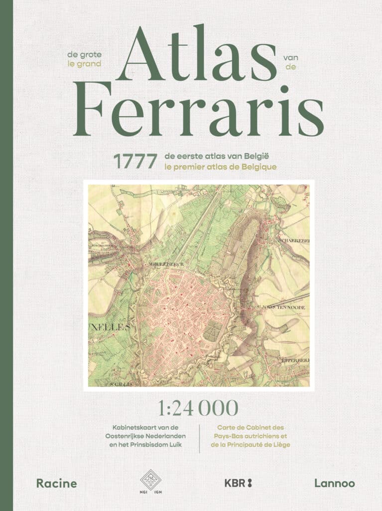
On the occasion of the 50th anniversary of the National Geographic Institute of Belgium and the 300th anniversary of the birth of Count de Ferraris (20 April 1726), the Ferraris Atlas is being republished based on new scans of the original map sheets and at a scale of 1:24,000.
For this edition, the original map sheets preserved at KBR were scanned again in greater detail, with careful attention to faithful colour reproduction. The maps were then reduced to a scale of 1:24,000 to fit the book format. Thanks to this reduction, readers can compare the historical maps directly with contemporary topographic maps.
The Great Atlas of Ferraris will be published by Lannoo and Éditions Racine and will be available from 18 August 2026.
About the Maps and Plans Department
With one of the richest map collections in the country, KBR preserves a wealth of geographical information. The collection dates from the 11th century to the present day and covers Belgium and the entire world. Thanks to careful conservation, these historical sources are preserved for future generations.